FLAPRIS: A Smart Assistant Not Only for Flash Flood Threats
Technology description
| The name of the technology: | FLAPRIS: A Smart Assistant Not Only for Flash Flood Threats |
|---|---|
| Challenge: |
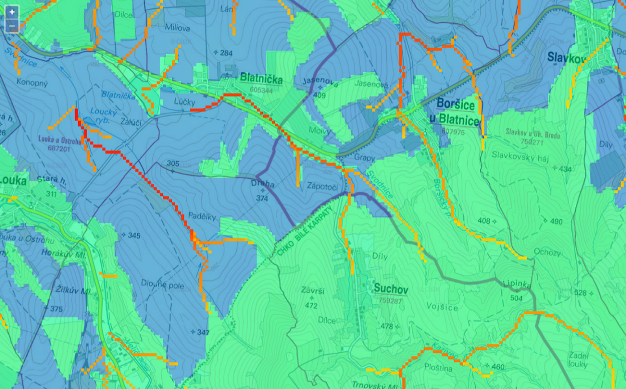
Flash floods can strike suddenly and cause significant damage. To help us prepare, the Czech Hydrometeorological Institute (ČHMÚ) has developed a tool called FFG-CZ. This system monitors weather using radar data and estimates where a flash flood might occur within the next hour. The results are displayed on maps covering municipalities with extended powers. A new technology currently being tested takes this prediction even further. The goal is to increase the accuracy of warnings down to the level of individual municipalities, and even smaller areas within them. Thanks to calculations that take terrain and rainfall intensity into account, the system can determine exactly where water is likely to flow—with a resolution of 50 × 50 meters, roughly the size of a small city block. In addition, surface runoff maps are created to illustrate how water may spread across larger areas. This helps emergency services, local governments, and residents better prepare for potential flash flood risks. |
| Description: |
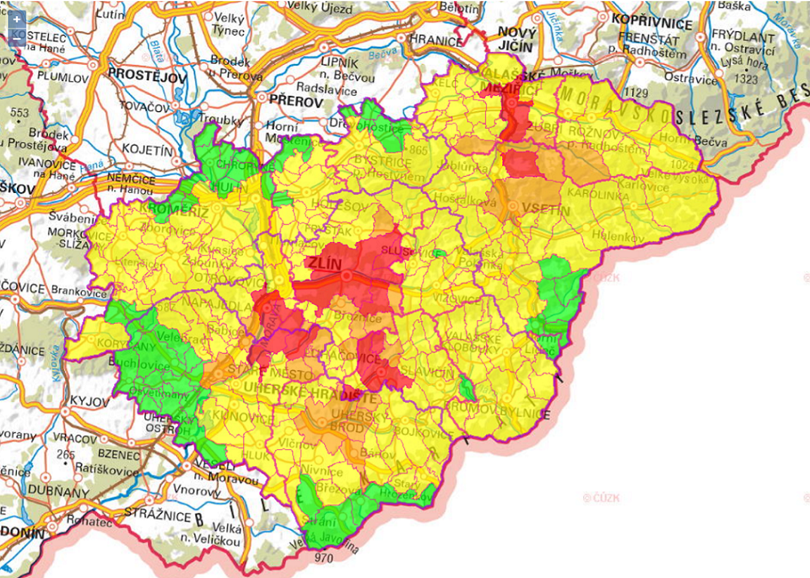
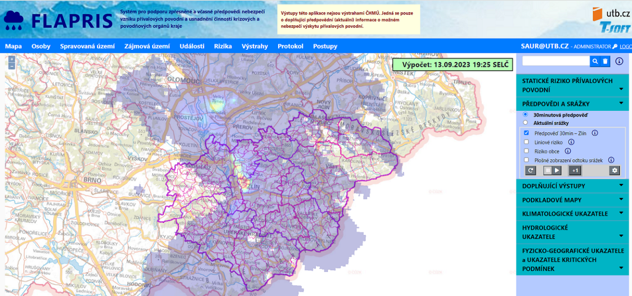
Flash floods can strike quickly and cause serious damage. A new project in the Zlín Region aims to improve the prediction of these dangerous events and make the work of emergency and flood response teams more efficient at both regional and municipal levels. The main goal is to create a system that can provide timely and accurate warnings about flash flood risks. This system combines meteorological data, terrain information, and historical flood records. Using artificial intelligence, it evaluates where problems are most likely to occur—every five minutes. The result is a set of risk maps with four levels of danger, generated for selected municipalities with extended powers in the Zlín Region. This allows emergency teams to respond quickly and prepare for potential flooding. The project also includes automation and optimization of emergency procedures, meaning that authorities will have clear and fast information to support decision-making. This can significantly help with organizing rescue operations or warning residents. In the future, the system is expected to become even more accurate—thanks to the addition of new historical flood data and improvements in weather forecasting models. The goal is to ensure that warnings are timely and as precise as possible. |
| Commercial opportunity: |
The modern FLAPRIS system is now being put into practice. It helps issue early warnings about flash floods and supports the work of crisis and flood response teams. The main users are staff at regional authorities and municipalities with extended powers, responsible for public safety during extreme weather events. FLAPRIS uses smart algorithms and automation to quickly assess risks and provide clear, timely information. This enables crisis teams to make better decisions and protect both people and property more effectively. In the near future, the system is expected to become part of a broader early warning network for extreme weather. One major advantage is that the Zlín Region can use the project results free of charge, making the solution more accessible and beneficial to the public. After a period of operation, the system will be evaluated based on user feedback and forecast accuracy. The project also includes training for crisis management staff, so the system can be effectively used across all regions of the Czech Republic. |
| IP protection status: | Patent application in the Czech Republic is in progress. All results achieved within the project are protected under copyright law. |
| Development status: |
Phase 3Corresponds with TRL 5 and TRL 6 Technology validation and implementing it in real environment. Testing the technology outside of the laboratory and its adjustment to external conditions.
|
| Partnering strategy: | Collaboration licensing |
| More information: | |
| Images: |
|
| Categories: | Artificial Inteligence Software Hardware |
| Institution: | Tomas Bata University in Zlín |
| Owner of a technology: | Univerzita Tomáše Bati ve Zlíně a T-SOFT a.s. |